Swiss Ultra Cycling Challenge 2023
September 06–September 10, 2023
The Event and Entry
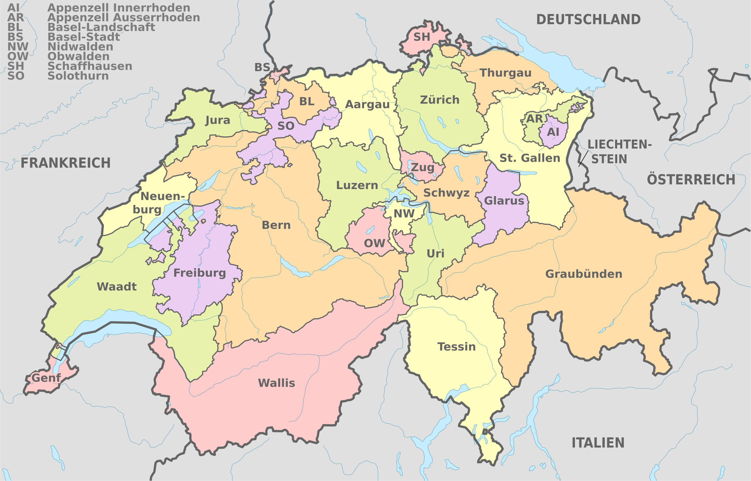
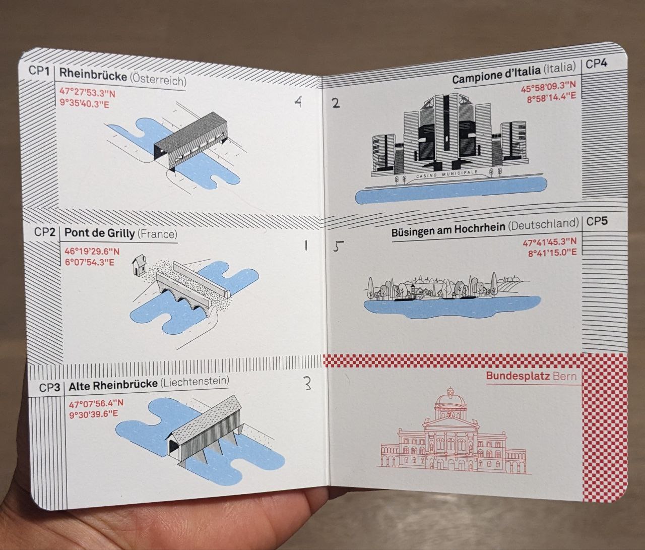
The Swiss Ultra Cycling Challenge (SUCH) is free-route ultra-distance cycling event that challenges competitors to visit all cantons (administrative divisions) of Switzerland plus a number of set checkpoints with caveats. This year's twist was that the five checkpoints were foreign; travel outwith Switzerland was normally–and in all other cases continued to be–strictly forbidden. These included checkpoints in the Italian and German enclaves, Campoione d'Italia and Büasingen am Hochrgein. In particular these territories would be valued as cantons i.e. in exchange for visiting them only 24 of Switzerland's 26 cantons needed to be visited. This kept the nominal event distance to around the 1,000 km of previous editions and made the key question when routing planning: which cantons to skip?
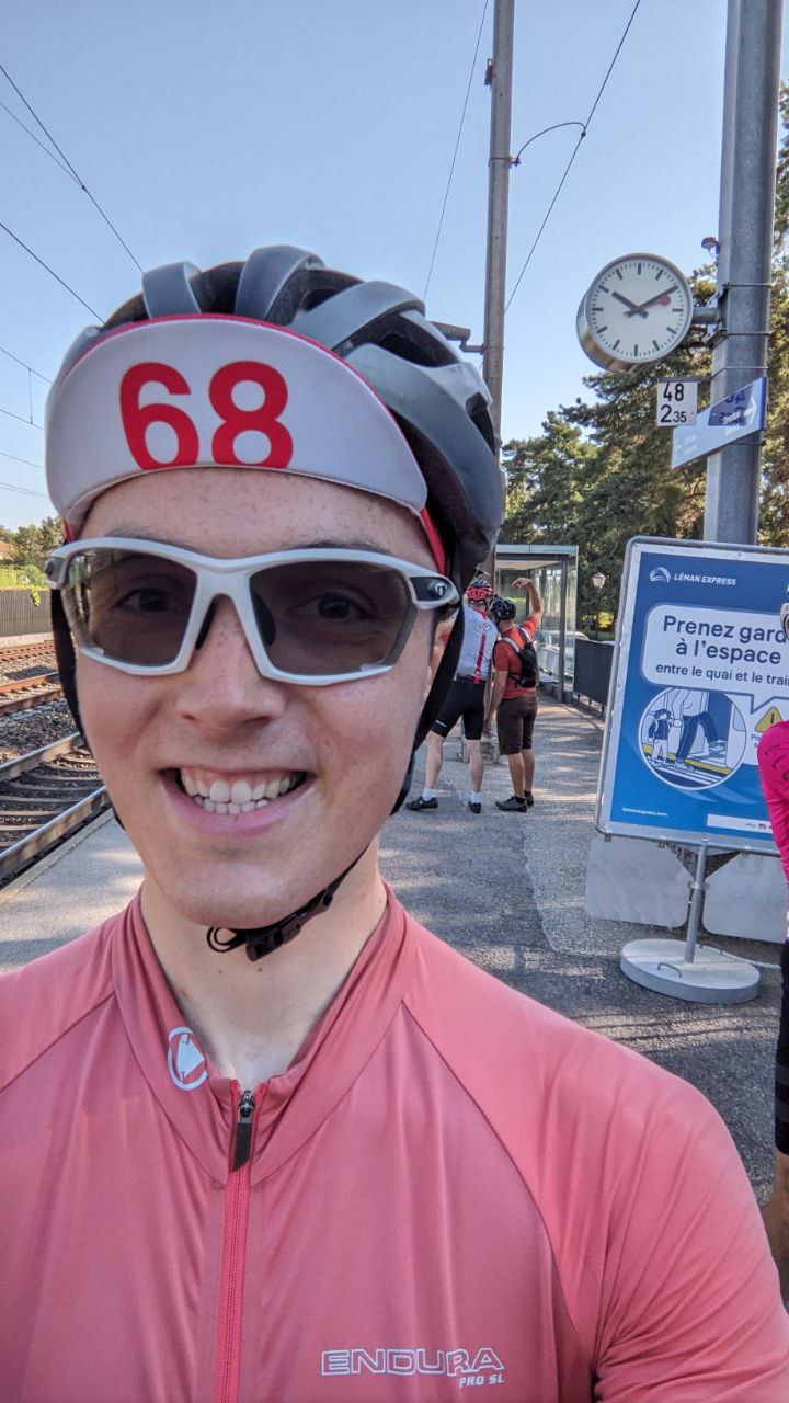
A standout feature of SUCH is that not only is the route free i.e. you devise your own between cantons, but so also is the starting point: you can start from any Swiss railway station, specifically at 10 past 10 on Wednesday 6 Sep., with a photo of you and the iconic Swiss platform clock to mark your departure. The infinite routing possibilities this presented was definitely a reason I signed up for the waiting list back in June. I had just completed the Alba Rosa Ultra and All Points North races in North England and picked up the ultra-cycling bug.
When the organiser Marc emailed late July saying a spot had become available, I was greatly excited at the possibility of seeing Switzerland and the alps it contained. I said would need a few days to get back, to see how I could make flights and accommodation work around the event. 'Stay with me, no problem!' he replied. Well that was decided then!
The Route
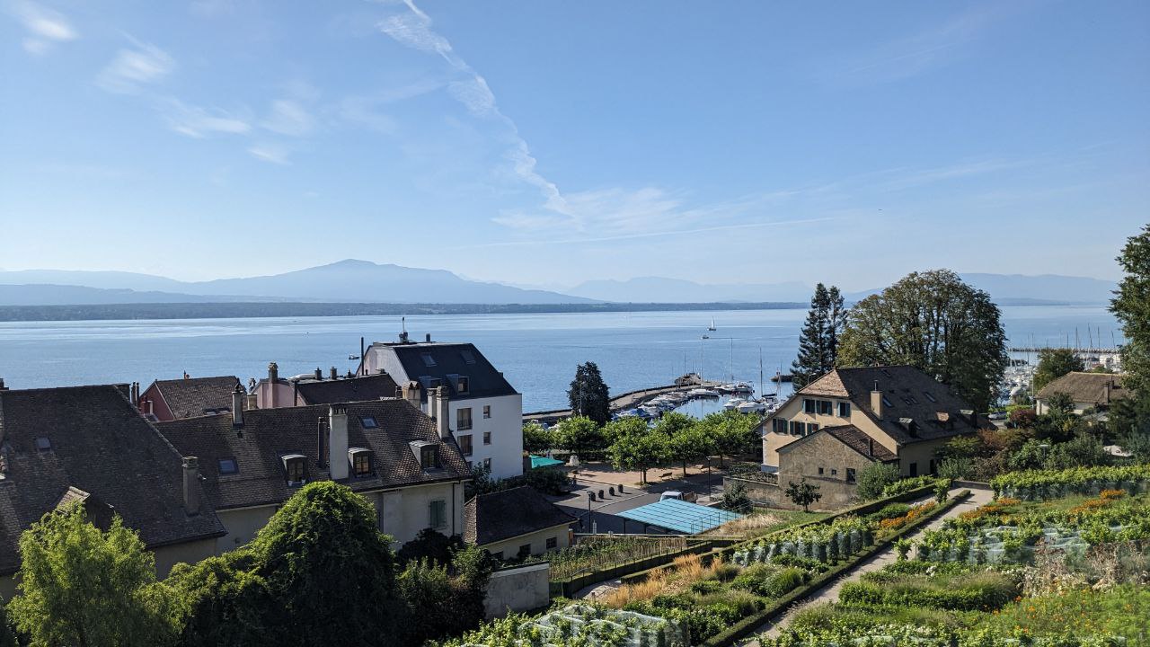
Geneva was the easiest city to travel to from Edinburgh and I now had the offer of accommodation, so I started planning my route on the basis of starting in nearby Tannay, where Marc lived. As it happened, Tannay was the closest station to one of the checkpoints (CP2, Pont de Grilly), so it shouldn't have been an uncompetitive starting position in principle. However, shortly after arriving I realised the most popular start choice near the Italian enclave had the considerable advantage of requiring fewer or at least less severe alpine passes.
I planned to loop the country anticlockwise, I think because I wanted to get the alpine climbing done early on. In retrospect this wasn't ideal, since that meant a long ride through the valley in Valais, making my route longer than most. I say 'ideal'; at these events you get the entire spectrum amongst entrants from out-and-out races to those looking to enjoy or simply complete the epic challenge. I felt somewhere in between, I wanted to go as fast as I could but on the 'full value' route I'd ended up with! [the Tracking page has me recorded over 50 km longer than anyone else!]
The Ride
Part 1
10:10 on Wednesday, 2023 September 02, Tannay, Vaud
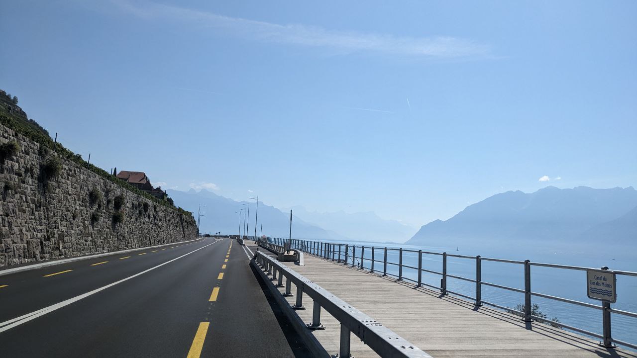
Turning up at Tannay station I was relieved to see at least a few other riders had chosen the same starting point, although from those all but a pair would be going clockwise to avoid the Valais valley. Opportunity for brief chats as we made the short trip to the first checkpoint on the French border. A slightly longer conversation Bib 10 Matthias along Lake Geneva before our routes split. I picked up a few tips: in addition to a clock most rail stations in Switzerland had a vending machine dispensing snacks and drinks. A good emergency option if out of food late at night (shop closing times in Switzerland are quite early, generally 6-7pm at the latest outside the big cities). Mentions of my valley route were met with grins–not the most expedient option! ('Maybe you will have a tailwind?')
By noon is was touching 30 degrees under a cloudless sky, conditions that would repeat on subsequent days. Fab cycling weather as far as most were concerned, but challenging temperatures for me that would make each afternoon hard going. A saving grace is that every other village in Switzerland has a water fountain or tap with drinkable water. So that was one concern lifted. Another positive of the daytime heat was that night riding was pleasant and safe; one could probably lay down anywhere outside and sleep without risk of hyperthermia or even discomfort. That being said, I intended to use hotels for sleeps, with a list of about 15 on my cuesheet spread out over the course to hopefully cover all possibilities of how the event would unfold.
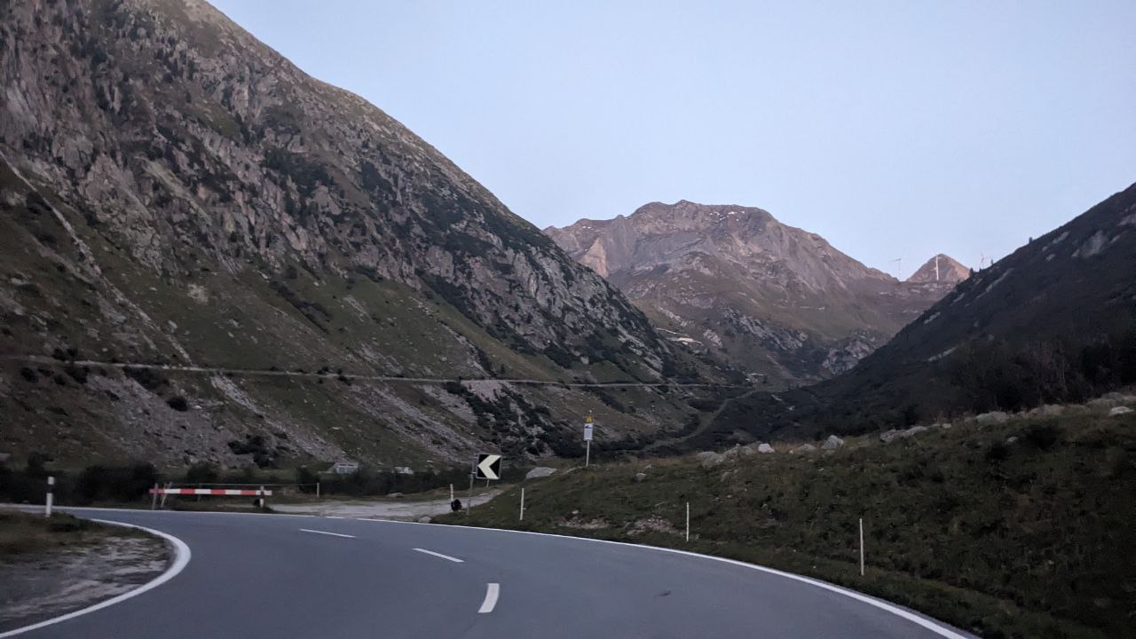
Progress was excellent along the flat valley despite any grievances with the heat. I knew reality would quickly kick in once I reached my first climb however: Nufenen pass into Ticino. Going in to the event I really wanted to avoid being on the side of some mountain in absolute darkness, but of course that's exactly what happened. The fading light and clatter of bells on cattle you couldn't quite see made for quite an eerie experience. The climb was fair, hard work but straightforward. About a third of the way up the GPS on my head unit decided to freeze and then I really was riding 'in the dark.' Fortunately there was really only one way, the road up, and restarting the cycling computer once I reached the top got the GPS working again. The device would play up several times over the coming days which would prove an annoyance but not more serious.
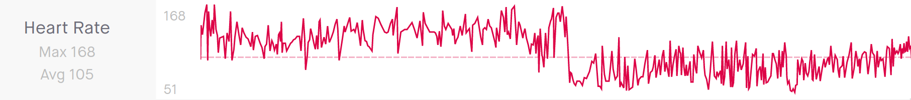
The scale of the undertaking I was now engaged really did hit me. On the road for 12 hours (250 km) and still over 100 km to reach the only the second of five checkpoints I needed to tick off. Mostly descent, but not easy to enjoy with the knowledge after reaching the checkpoint I would have to turn around and immediately ride back up almost all of it! Interestingly, from my heart rate data you can clearly see a 'before' (120-140 BPM) and 'after' (80-100 BPM) Nufenen: once I lost my output on the descent there would be no getting it there would be no getting in back for the remainder of the rip.
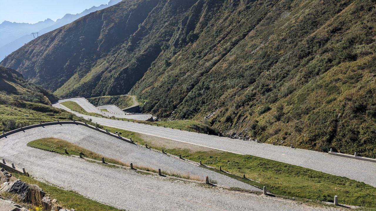
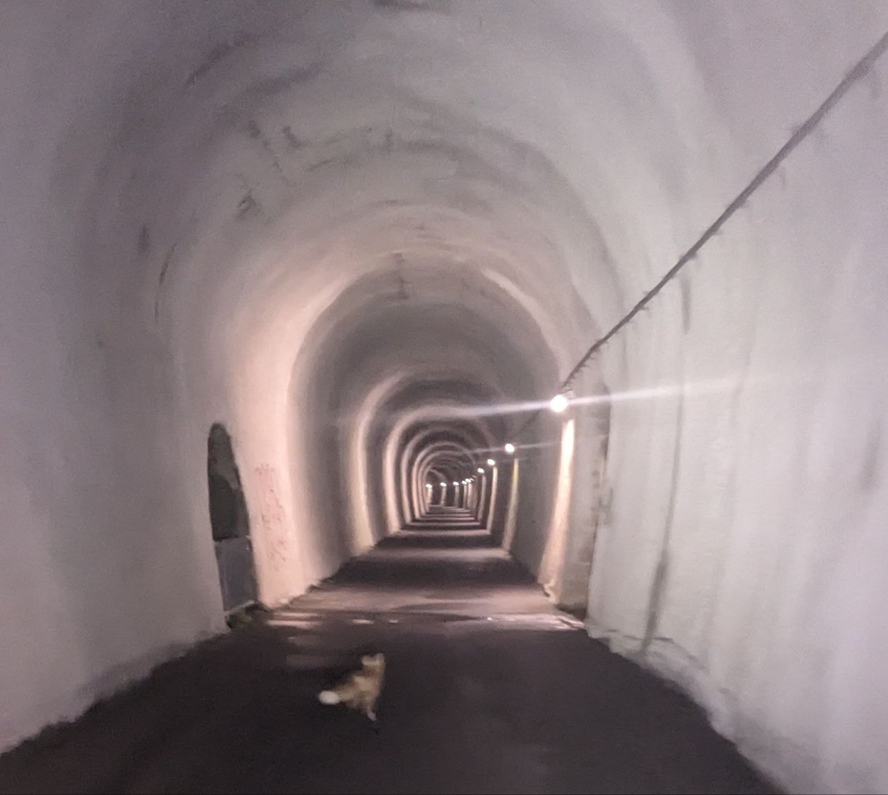
Going into the first night I had some trepidation about whether I could do it without sleep, given the morning start (often ultras kick off in the evening to make the night shift more manageable), but it turned out to be just fine. Looming now was the second big ascent on the route, Gotthard pass. Marc had insisted to do the old road rather than the newer one taken by most motor traffic. This was at least two third cobbles and he wasn't wrong, absolutely iconic. Extremely testing now 24 hours (440 km) into the ride though, and the heat of day 2 had already set in. Staying upright was the first priority, moving forward a close second. I just about managed both, Strava says 1 hour 40mins for the whole climb. Slow but great sense of achievement and then a truly rewarding descent. The first part was direct and fast; I caught a moped riding looking very shaky in the swirling winds. He pulled in to let me and another car pass. Then it really got magical. We followed perfectly surfaced roads through tunnels that weaved in and our of the mountainside, with immense views of the surrounding peaks. What an experience. At the bottom I almost wanted to turn around at and go again. Ha ha, nope, just kidding. But I will certainly be visiting again!
It couldn't all be plain sailing and alas I was about to hit severe disruption. In the preceding weeks we'd be warned that the road from Siskon to Brunen would be closed to cyclists. No paved alternatives for possibly hundreds of kms. Okay, a short detour via a gravel track looked feasible. Should be fine, I have wide tyres and tubeless now. How I had failed to realise that it was almost vertical! What looked like a small blip on the overall profile was in fact 400 m upwards from the closed road. While Gotthard had felt like the ultimate test at the time this, this almost broke me. In the now searing heat I pushed my bike up 20 percent gradients struggling for purchase in the loose gravel. It seemed to take hours, and the hotel I had booked just minutes before at 750 km was now an impossibility to achieve that evening, not least because it was actually more like 780 km–my notes had been wrong.

Anyway, I did eventually reach the top of the hike-a-bike and immediately down equally steep but–thank all on heaven and earth–paved roads and back onto the route proper. Trying to make up for lost time and the target of a closer hotel (720 km) proved difficult. I was hot and bothered and physically pretty spent. Small road closures and detours added to frustration. 6pm became 7 became dark and by the time I was approaching the hotel it was going 11pm, 37 hours since I set off.
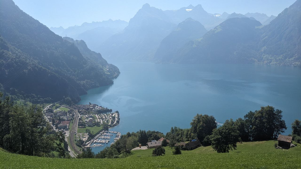
I'd decided to take national cycle route 9 along Lake Walensee. These routes had been pretty good so far but well, I guess my luck was out. Tight corners and tunnels with short rises and lots of gravel. I'm sure it's a special experience in daylight without time pressure, but in the darkness it was demanding and stressful. It felt like yet another battle had just popped out of nowhere right before the end of the first part of my ride. My GPS was playing up again, this time no cuesheet, so I didn't really even know how long it went on for except for vague distances I recalled from when route planned.
Finally I reached the town Murg containing the hotel. Of course, I then couldn't find said hotel and proceeded to spend around 15 minutes looping around town and TWANG, a spoke on my rear wheel goes. I limped to my room in the self check-in hotel with this extra problem but resolved to make the next 'day' (it was in fact already Friday) a fresh start. Alarm set for just under 4 hours of sleep.
Part 2
04:34 on Friday, 2023 September 08, Murg, St. Gallen
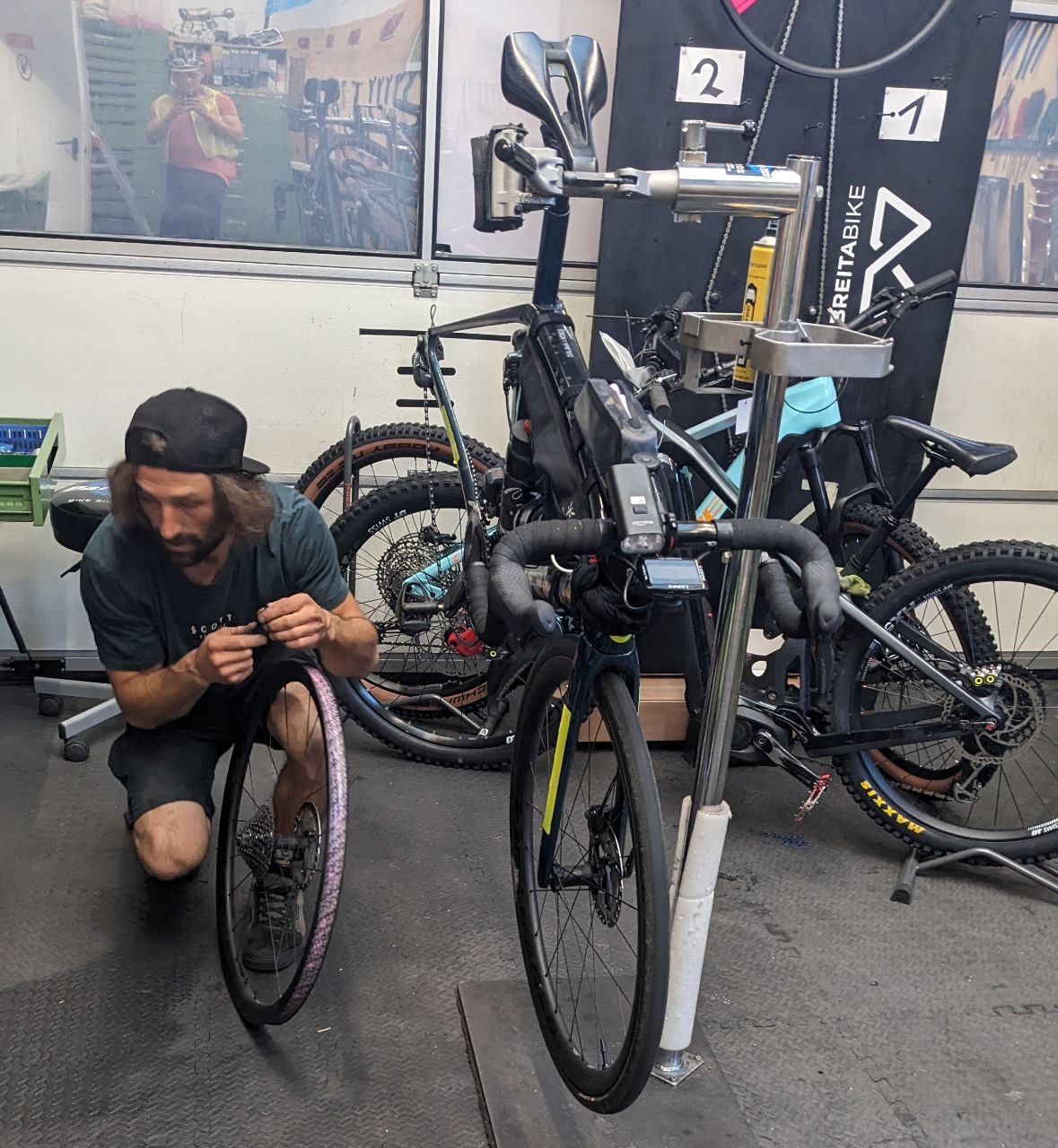
Looking back I have to think I was extremely fortunate the spoke went when it did; a few revolutions later would have made for a really nasty surprise setting out. Instead I was able to form a plan: continue on to the next checkpoint–this time taking the main road instead of the gravel path–hope the wheel held, and get to the first bike shop I'd spotted on the route in Oberriet. The wheel held, the shop was open and then a new spoke was fitted in half an hour. Cracking turnaround and an efficient start to Part 2.
A little more climbing to get the Appenzell cantons before a checkpoint on the Austrian border, and then I turned West. The finish no longer seemed like a remote dream. Could I do it all in one go or would I need another stop? Things would soon become a slog, first to Schaffhausen and the German checkpoint, and second to Basel. The sun was in full force and heading West meant it would be blinding me for the next 6 or 7 hours. My bum and saddle had fallen out, and my toes were throbbing in my shoes. No particular pain, just long-ride discomfort. Like an unscratchable itch, I kept switching positions, angles and weight distribution to no avail. Ultimately it didn't matter: I was still moving forward, if slowly.
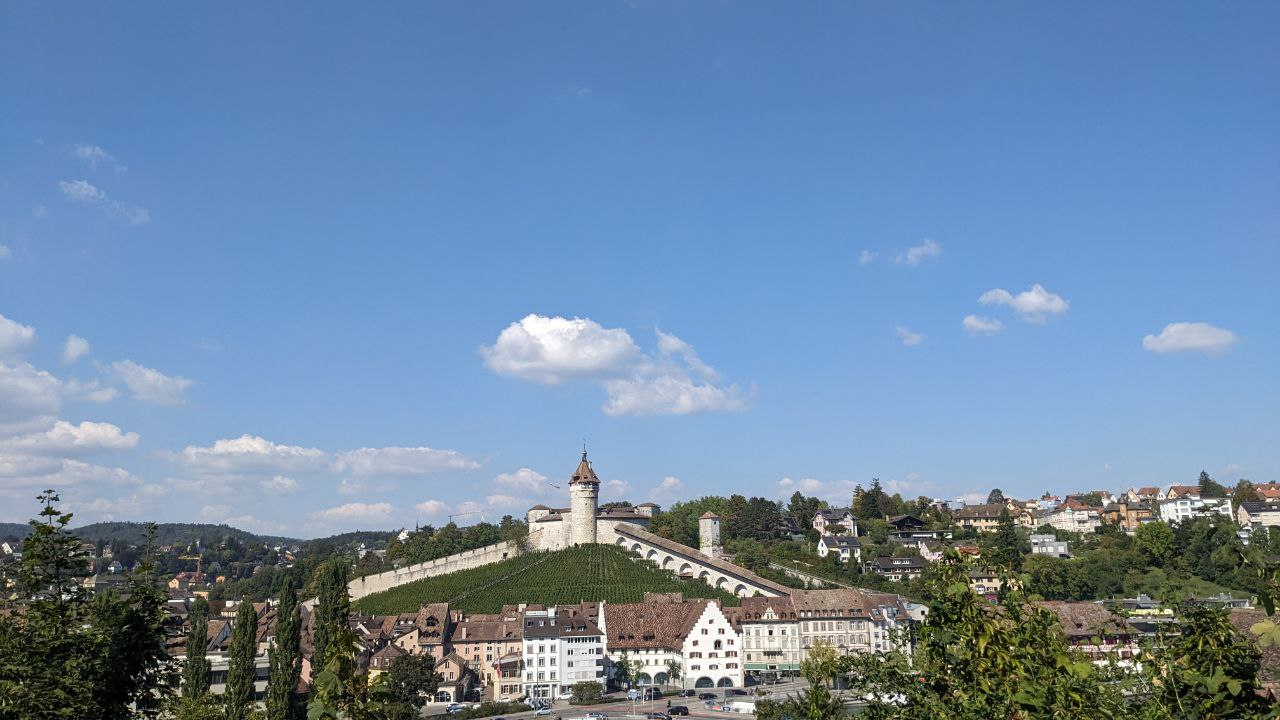
Schaffhausen to Basel in particular felt like it took a long time. So very long. It was after 9pm I think when I reached the city to find somewhere to restock. Like I said it had been quite a slog, but I was still determined to get supplies and push on for another 35 km to an Ibis hotel in Delémont at the foot of the last major climb I had to take on. That was the plan, but leaving Basel with a good array of treats (admittedly taking 3 petrol stations–late night shopping really is poor here) including some absolutely class mini karamell waffeln, my outlook quickly changed. I started to feel more and more excited about the finish. I'd forgotten about being uncomfortable and energy levels seemed to be increasing rather than decreasing. A few messages exchanged with my ride partner @mealybar back home for a sanity check: I was going to push to the finish.
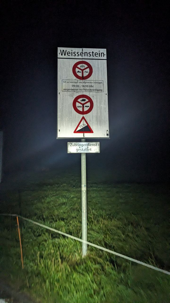
The remaining ascent was Weissenstein, possibly the purest climbing challenge of the lot. Not as long or high as Nufenen and Gotthard, but 5 km of relentless gradients. Its mention also got some surprises (head-shakes) from others at the finish. Boy I'd really picked them out. I wasn't fazed though, nothing was going to stop me physically now the finish was only 70 km on the other side. Pass midnight, again. Pitch black on a mountain, again. Not another soul around. I switched the display on my cycling computer so as to not get distracted by numbers; best to treat it as an indefinite effort with a nice surprise when over rather than wear yourself out checking the distance remaining every few pedal strokes (your mileage may vary–mental strategies are personal but seriously important for such tasks).
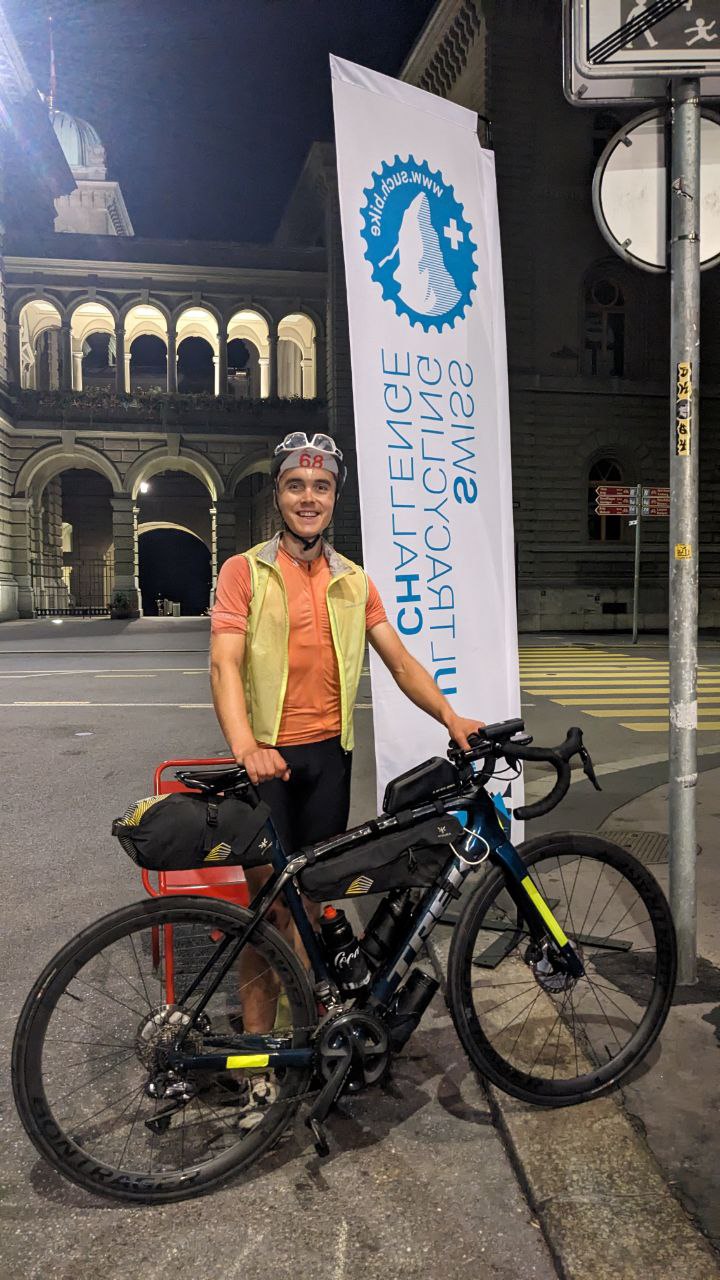
The final run-in to Bern felt lightning fast on clear and often street-lit roads even if the reality was a snails pace. Across the city's cobbles to the Bundesplatz (plaza) where Marc and a few recent finishers awaited. What an experience.
Time 66 hours, Distance 1,130 km, Elevation > 13,000 m (?*)
Thanks to organisers Marc and Vincint and all the helpers making the event happen. But most of all Marc for so generously allowing me to stay at his own home and giving the warmest of welcomes to the SUCH family. Nothing short of bowled over by the hospitality and his dedication to the event he is clearly so passionate about. I hope to attend future editions!
*approximate from the plotted route (GPS elevation recording failed a couple of times, notably up Nufenen).
Other Notes and Links
- On the Sunday after the event there was a finishers meal on Bundesplatz coinciding with a Race For Life charity event around Bern
- The race tracking and results provided can FollowMyChallenge can still be viewed online.
- such.bike is the best place to find out more about the event, previous editions and of course enter! There is also a short report on dotwatcher.com.
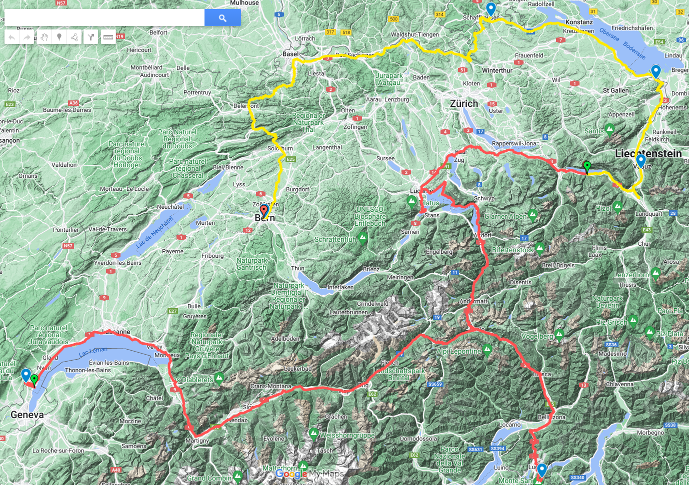
- My own route can be viewed on Google Maps